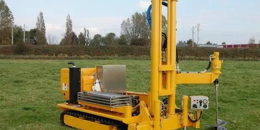
The hydraulic push system on a 20-tonne CPT rig advances a 10 cm² cone at a constant 2 cm/s, measuring tip resistance and sleeve friction through Coquitlam’s complex stratigraphy. In the Lower Mainland, where the Fraser River’s historical migrations left interbedded sands and silts beneath dense lodgment till, the continuous profile from a seismic CPTu captures thin soft layers that SPT blow counts often miss at standard 1.5 m intervals. Our operators run the cone from stabilized truck platforms right off Lougheed Highway or from tracked carriers on the slopes above Como Lake Road, ensuring vertical alignment even on 15% grades. The pore pressure transducer measures dynamic u2 response during dissipation tests, which gives us a direct estimate of the coefficient of consolidation in the compressible clays that underlie much of the city center. We calibrate the cone against ASTM D5778 procedures before each mobilization, and the data acquisition system logs readings every 2 cm of penetration to catch the transition zones that dictate pile toe elevation decisions. When the profile hits a dense till layer at 18 to 25 m depth, the sleeve friction spikes and we correlate the friction ratio to soil behavior type using Robertson’s 1990 chart—a method that has proven reliable across hundreds of sites in the Tri-Cities area. For projects where shallow foundations are proposed, combining CPT data with shear wave velocity measurements allows us to cross-check the small-strain stiffness against the large-strain cone resistance, improving the site class determination per NBCC 2015.
A continuous CPTu profile at 2 cm sampling intervals catches the thin soft seams that SPT split-spoon recovery misses—and in Coquitlam's interbedded glaciolacustrine deposits, those seams control both settlement and liquefaction.
Methodology and scope
Coquitlam’s post-war boom transformed orchard land into subdivisions at a pace that rarely accounted for the buried peat lenses and soft compressible deposits trapped between the Vashon till and the underlying bedrock. The city’s expansion northward toward Burke Mountain and westward into the floodplain near the Coquitlam River has pushed development into areas where static cone penetration provides the only practical method for profiling 25 to 35 m of mixed alluvium without washout or sample disturbance. A single CPT sounding in the Maillardville neighborhood fifteen years ago revealed a 2.4 m thick normally consolidated clay band at 11 m depth that the adjacent SPT split-spoon had completely liquefied during hammering—since then, the municipality’s geotechnical review board has favored cone data for critical infrastructure near the river corridor. Our CPT rigs carry 350 kN of push capacity, enough to punch through the cobble-rich layers at the till contact without predrilling in most cases. The pore pressure dissipation test, run immediately after reaching a target depth, typically reaches 50% consolidation within 8 to 15 minutes in the silty clay units common along Brunette Creek, yielding an operational hydraulic conductivity value that directs dewatering design for deep excavations. We process raw cone data through CPeT-IT to generate corrected tip resistance, normalized soil behavior type plots, and undrained shear strength profiles calibrated to site-specific Nk factors derived from field vane tests. The friction ratio log, when plotted alongside the pore pressure ratio Bq, separates drained sands from undrained silts with a classification accuracy exceeding 85% in the glaciolacustrine deposits that dominate Coquitlam’s subsurface. For projects requiring liquefaction assessment under the M7.3 scenario, the CPT-based method of Robertson and Wride (1998) computes the factor of safety against cyclic softening at every 5 cm increment, producing a far more granular picture than the SPT-based procedure in the NCEER workshop report.
Local considerations
The NBCC 2015 and the BC Building Code 2018 assign Coquitlam a Site Class C to E depending on the presence of soft soils, which triggers amplified spectral accelerations that can double the seismic base shear for mid-rise structures compared to a firm ground assumption. A single misclassified site—calling it Class C when a continuous CPT log would have revealed a 3 m layer of soft fine-grained soil and pushed it into Class E—can result in a structural design that underestimates lateral forces by 40% or more. The cone friction ratio and pore pressure response in the alluvial silts near the Coquitlam River corridor frequently indicate contractive behavior under cyclic loading, meaning these soils are candidates for flow liquefaction rather than just cyclic mobility; the Robertson 2016 updated CPT-based triggering curves are the standard we apply when the seismic hazard deaggregation shows a magnitude 6.8 to 7.5 event at a distance of 60 to 80 km from the Cascadia subduction zone. In the hillside subdivisions north of David Avenue, the cone refusal depth varies dramatically over short horizontal distances as the till surface undulates, and assuming a uniform bearing stratum from sparse borehole data has led to differential settlement claims on more than one townhouse project in the past decade. The CPTu dissipation data often reveals perched groundwater within the weathered till crust that does not appear on standpipe piezometer readings until the wet season, and failing to account for this perched water in the lateral earth pressure calculations has caused retaining wall distress along several arterial roads. The biggest legal risk we see is the absence of a pore pressure measurement—without the u2 channel, the effective stress interpretation is blind, and the corrected tip resistance qt cannot be computed, making the entire profile non-compliant with the ASTM D5778 standard that the APEGBC guidelines reference for foundation investigations in the Lower Mainland.
Applicable standards
ASTM D5778-20: Standard Test Method for Electronic Friction Cone and Piezocone Penetration Testing of Soils, NBCC 2015 / BC Building Code 2018: Seismic site classification based on Vs30, SPT N60, or undrained shear strength from CPT, Robertson & Wride (1998) / Robertson (2016): CPT-based liquefaction triggering procedures for cyclic softening and flow liquefaction assessment, APEGBC Professional Practice Guidelines for Geotechnical Site Investigations (referencing CPT data quality and interpretation standards)
Quick answers
What depth can a CPT rig reach in Coquitlam's glacial till?
In most of Coquitlam, the Vashon lodgment till appears between 18 and 30 m below ground surface and typically causes cone refusal at qc values exceeding 40 MPa. Our 20-tonne rigs with 350 kN push capacity can penetrate 1 to 3 m into the weathered till crust before refusal, which is usually sufficient to confirm the bearing stratum elevation. In the Austin Heights area where the till surface is shallower, refusal often occurs around 15 m, while near the Fraser River the till may be absent and we can push 35 to 40 m through alluvial deposits.
How much does a CPT test cost in Coquitlam?
Which soil behavior type classification do you use for CPT data in the Lower Mainland?
We apply the Robertson (1990) normalized soil behavior type (SBT) chart, updated with the Robertson (2016) modifications that account for the soil behavior type index Ic and the normalized cone parameters Qt and Fr. For the glaciolacustrine silts and clays typical of Coquitlam, the SBT classification reliably separates drained sands (SBT zones 6 and 7) from undrained fine-grained soils (SBT zones 3 and 4). We cross-check the CPT-based classification against Atterberg limits and grain size distributions from adjacent boreholes when available, which improves the Ic boundary calibration for the specific mineralogy of the Fraser Lowland deposits.
Can CPT data be used for liquefaction analysis under the BC Building Code?
The BC Building Code 2018 accepts CPT-based liquefaction triggering analyses as equivalent to SPT-based methods, provided the cone data meets ASTM D5778 quality standards and the interpretation follows recognized procedures. We use the Robertson and Wride (1998) method for the factor of safety against cyclic liquefaction, supplemented by Robertson (2016) for the post-triggering residual strength estimation in contractive silts. For Coquitlam sites within 5 km of the Coquitlam River, where the groundwater table is within 2 m of grade, the CPTu data typically identifies liquefiable layers between 3 and 8 m depth that correspond to the post-glacial floodplain sands deposited during the Fraser River's Holocene migration.
How many CPT soundings are required for a typical foundation investigation in Coquitlam?
The APEGBC guidelines recommend a minimum of three investigation points for a building footprint under 500 m², with CPT soundings replacing or supplementing SPT boreholes depending on the subsurface variability. In Coquitlam, where the till surface can undulate 5 to 8 m over a 50 m horizontal distance, we typically space soundings at 15 to 25 m centers for a mid-rise residential project and target one sounding per column line for irregular footprints. The municipality often requests at least one CPT sounding that reaches refusal plus a minimum of two additional soundings that cover the corners of the proposed excavation, particularly when the site is within the designated floodplain or near a steep slope where the geohazard review triggers additional requirements.