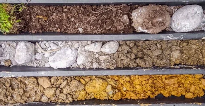
Glacial till and advance outwash deposits dominate the subsurface across Coquitlam. The city sits on a complex stratigraphy shaped by the Fraser Glaciation, with compact lodgement till overlying glaciomarine silts and sands. A shallow groundwater table complicates foundation design in the lower reaches near the Coquitlam River. These conditions demand direct observation of soil structure. An exploratory test pit provides exactly that. The excavation allows the geotechnical engineer to log stratigraphy, measure in-situ density with a nuclear gauge, and extract undisturbed block samples from the till matrix. For sites on the flanks of Westwood Plateau, where colluvium thickness can vary abruptly, visual inspection of the contact between weathered bedrock and overlying diamicton is essential. The technique also supports slope stability assessments on steeper residential lots by revealing groundwater seepage planes and shear surfaces that borehole sampling alone would miss.
A test pit delivers what no borehole can: a continuous, full-scale cross-section of the ground, showing lenses, fissures, and water movement in real time.